

Eliza: Photo Journal – Moses Creek Preserve
Today I headed to a “new” destination on my second go-around in this area. I’ve been to Moses Creek Preserve once before. I was interested to see what changes have occurred in the meantime.
The preserve is located off of Florida SR 206, which can be accessed via I-95 and Florida A1A. Moses Creek is a tributary of Mantanzas River and is a salt marsh. There is a bridge over the river not far from the preserve.
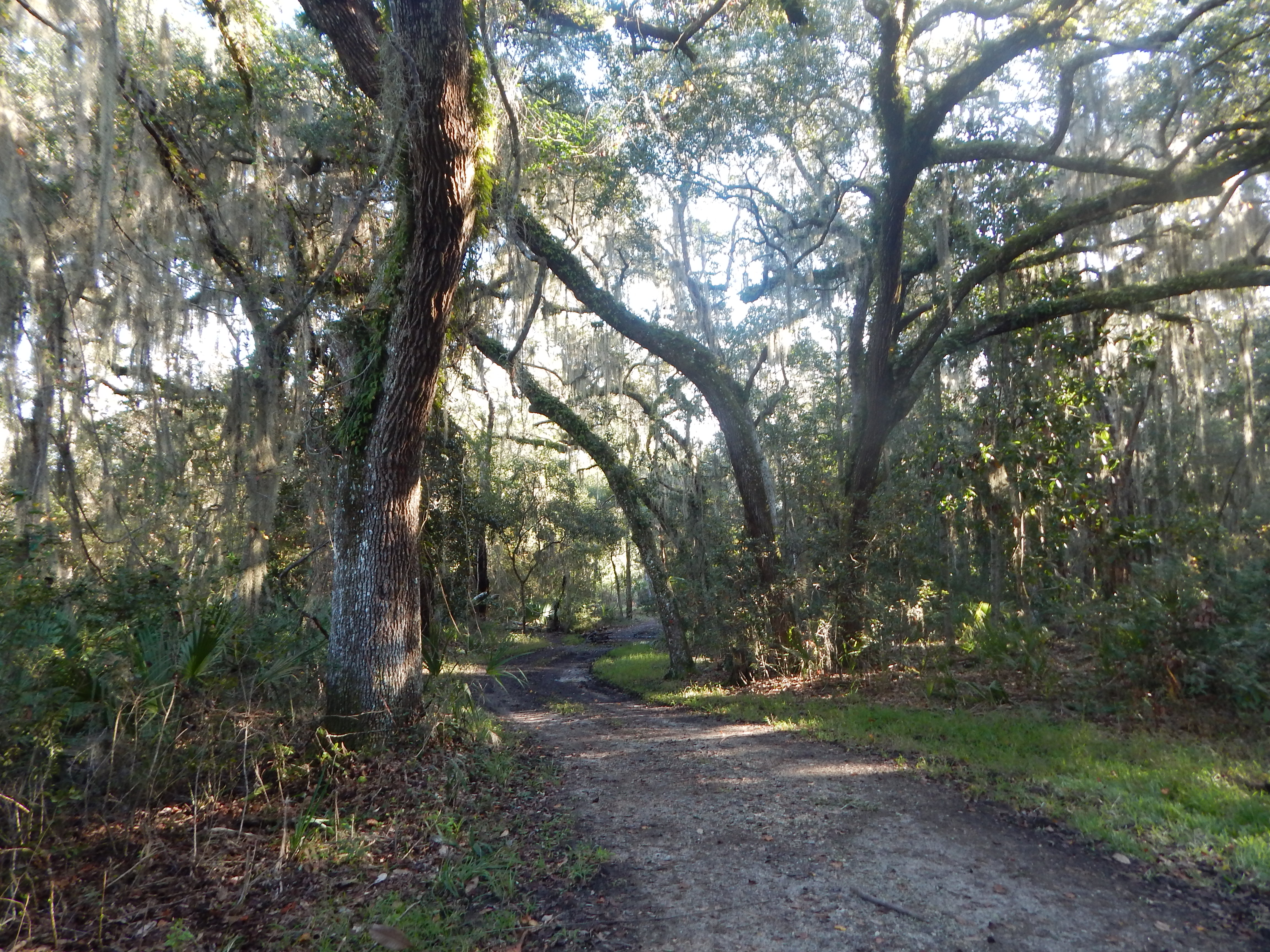
The trail starts off in a pine forest. The assortment of pines tower above the undergrowth. The old road trail was damp today but didn’t have any puddles to begin with. There was a distinct roar of traffic from nearby I-95, U.S. 1, and A1A, until I had made my way well into the forest.


Not too far from the parking area, you will come upon a sign indicating a bike route. I’ve actually hiked on this trail in the past. It loops endlessly through the woods and looks fun for experienced mountain bikers.
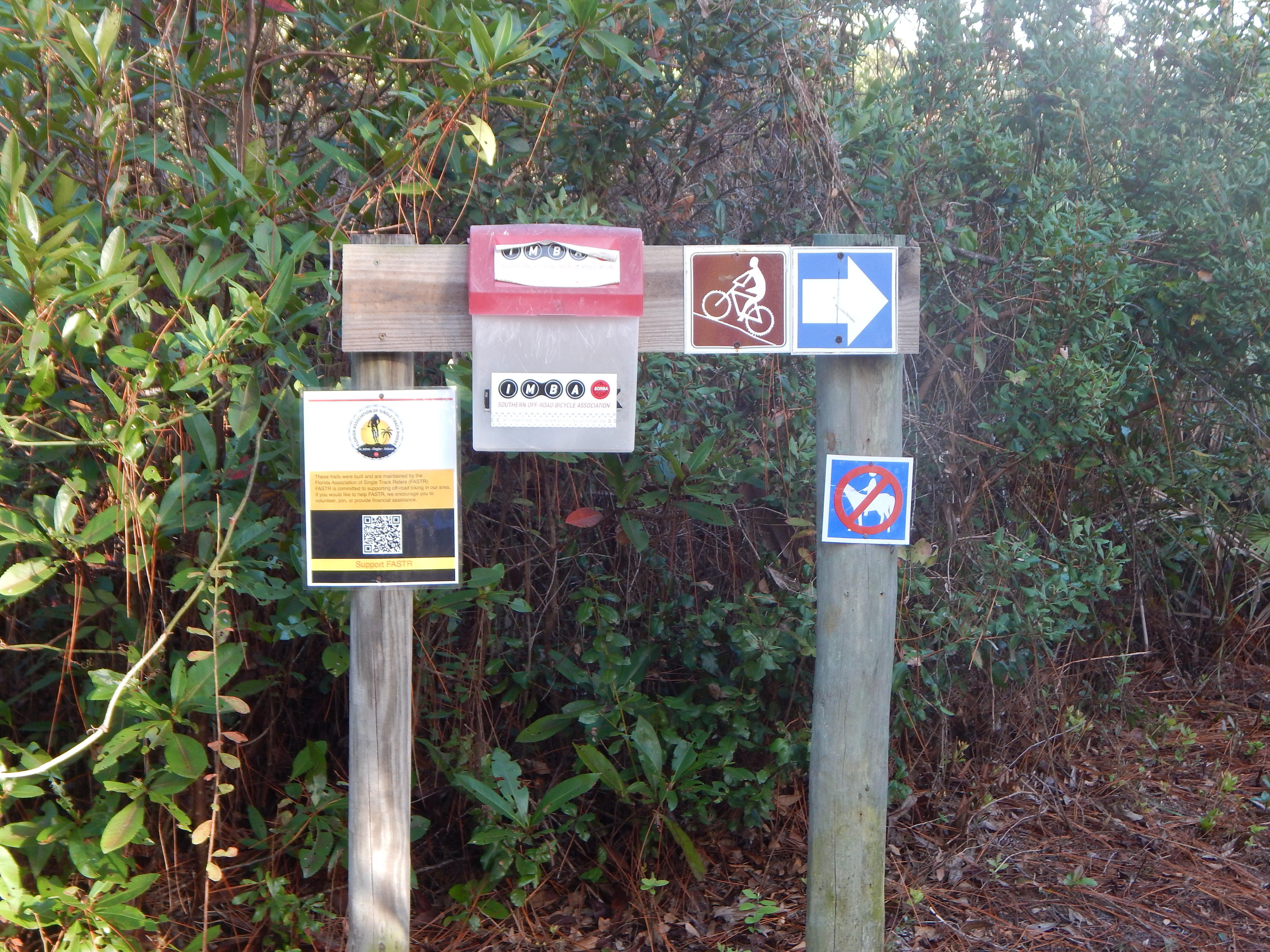
If horses are allowed on the main trail, it would be difficult to unload since both parking areas are small, without the turn-around space required for truck and trailer. No horses are allowed on the bike routes.

At. .4 miles, you reach another junction. If you go right, you will end up at a group camping site. I did go to the end of the road, but noticed someone was camping there and had driven in. Being alone, I exercised some caution and then dove into the nearby bike trail, knowing it would take me to the next side trail.
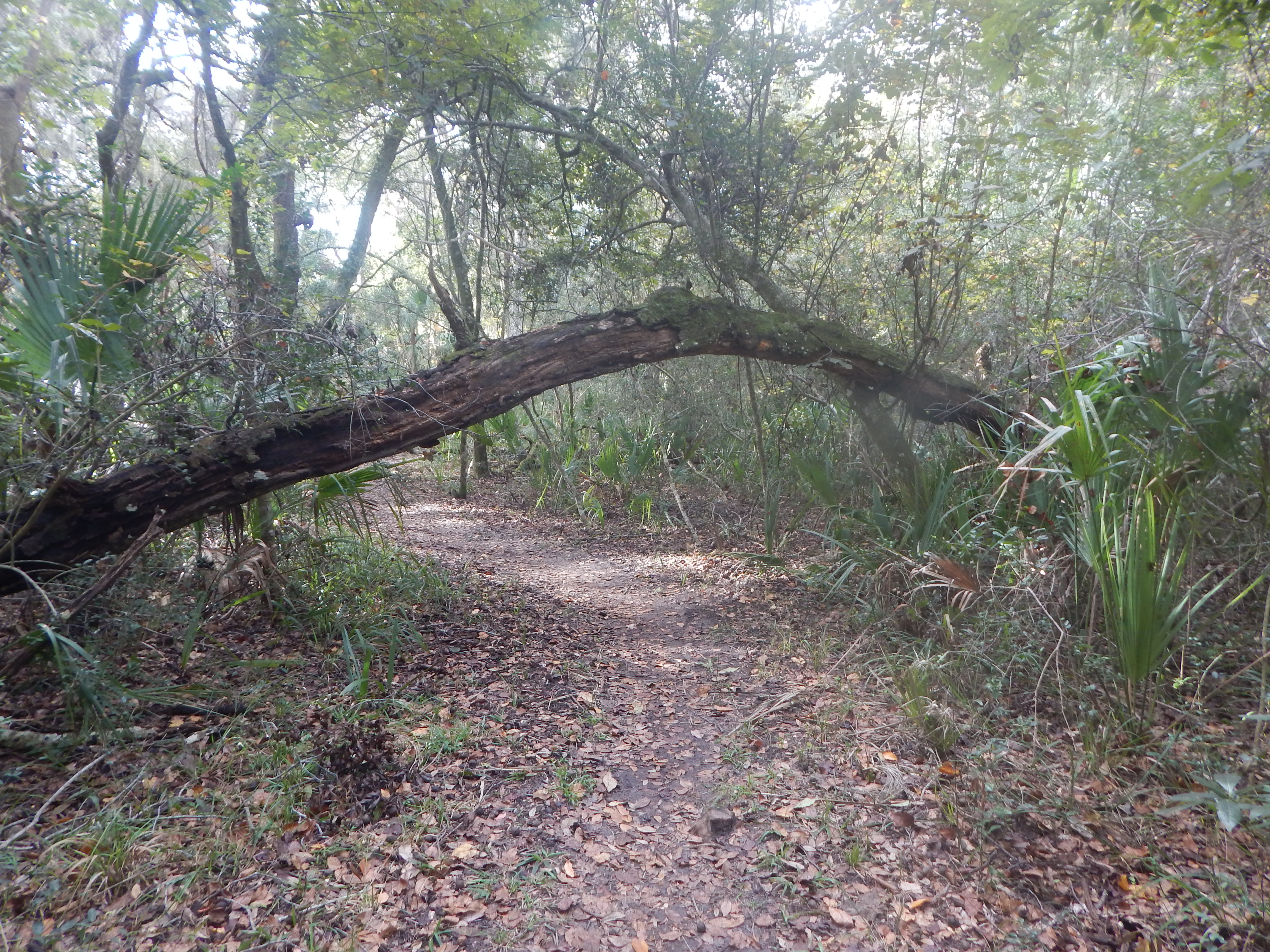
So, there I was doing loop d’loops through the forest on a firm but narrow trail.

There were even some nice bridges on the bike trail which kept me out of the gooey mud. I was concerned the planks would be slippery, but they proved dry enough for safe passage. While hiking in the past in Western Washington, I would have stomped through the mud in my waterproof boots and gaiters. I wasn’t equipped for that sort of thing today. I’ve been living in flip flops now for years… but I was wearing a good pair of walking shoes today.

The surface of the bike trail was hard-packed and only mushy in a few spots due to the bike traffic. I was fortunate no one was on the trail with me!
Eventually the bike trail dumped me out on the next side trail which the 50 Hikes in North Florida book describes as being a bluff with a view. That may have been true several years ago, but the tree canopy has grown up and now there is nothing to be seen except a wide sandy trail. I turned left and headed back to the main trail; I was done with the zig zag bike trail.
The main trail was very pleasant, wide enough for a truck, bikes, or walkers. I did not encounter anyone and followed the trail to yet another side trail. It dipped slightly downhill towards the creek and hopefully would give me some views of the salt marsh.

At two miles in (from the East Trailhead), you reach the third side trail and the intersection of the White and Yellow Trails. The Yellow Trail comes from the western parking lot; the white trail from the eastern parking lot. The Yellow Trail is the more direct route if you are doing a long version of this walk. I wasn’t planning on doing that, as I am still conditioning after a long hiatus from hiking. So, I headed down the third side trail towards the creek.
At the end of the side trail is a dock on the creek, and nearby a small camping area on the bluff above the salt marsh. The next series of photos are snaps I took of the creek and salt marsh. The area wasn’t particularly clear today — there being a lot of humidity and salt spray present, so the distant oceanside houses don’t show up. You can see the traffic on nearby A1A in the distance.


I saw a few wading birds flying in the salt marsh, a Great Blue Heron, Green Heron, and something unidentifiable. In the woods, I also saw several squirrels and what appeared to be a family of Pileated Woodpeckers (yes, Woody Woodpecker sorts) with their distinctive red head.

I sat down for a short break with a snack and some water. After my rest, I started back up the White Trail to the junction and then back to the car. It was here I encountered a few people, two women who were ushering a group of eight children. Other than a couple of bikers I spied through the underbrush whizzing past on the bike trail, these were the only people I saw on my outing.
The Yellow Trail continues on, but I’m not quite ready to tackle it. There is up to 12 miles of hiking possible if you go to the end of the Yellow Trail which curves around the salt marsh and ends at a camping area. Bikers could certainly handle such an undertaking. Backpacking and overnight camping is allowed. I’m not sure what sort of permission is required.
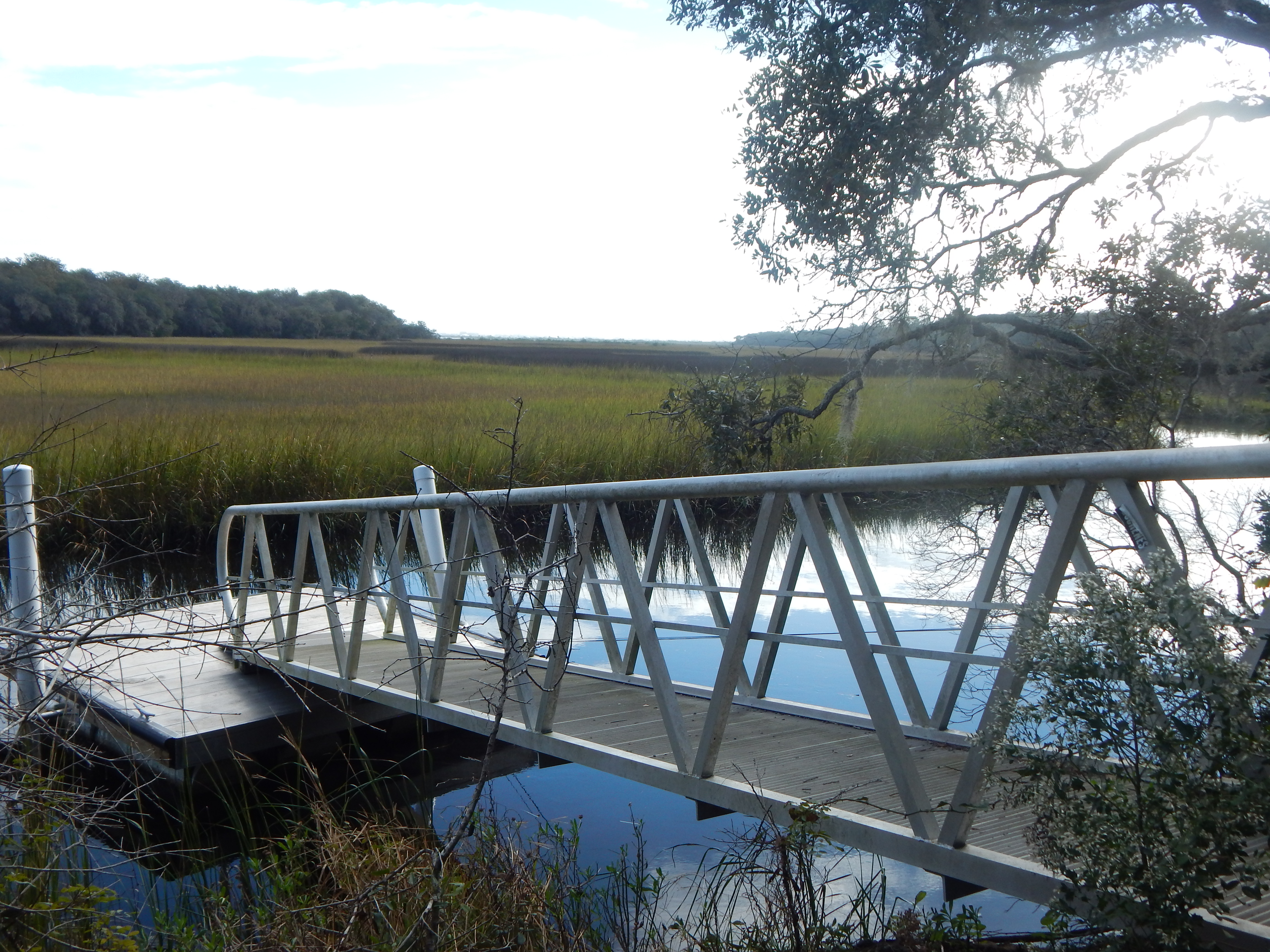
With one more look at the dock and its attached ramp, I began the climb back up the hill.
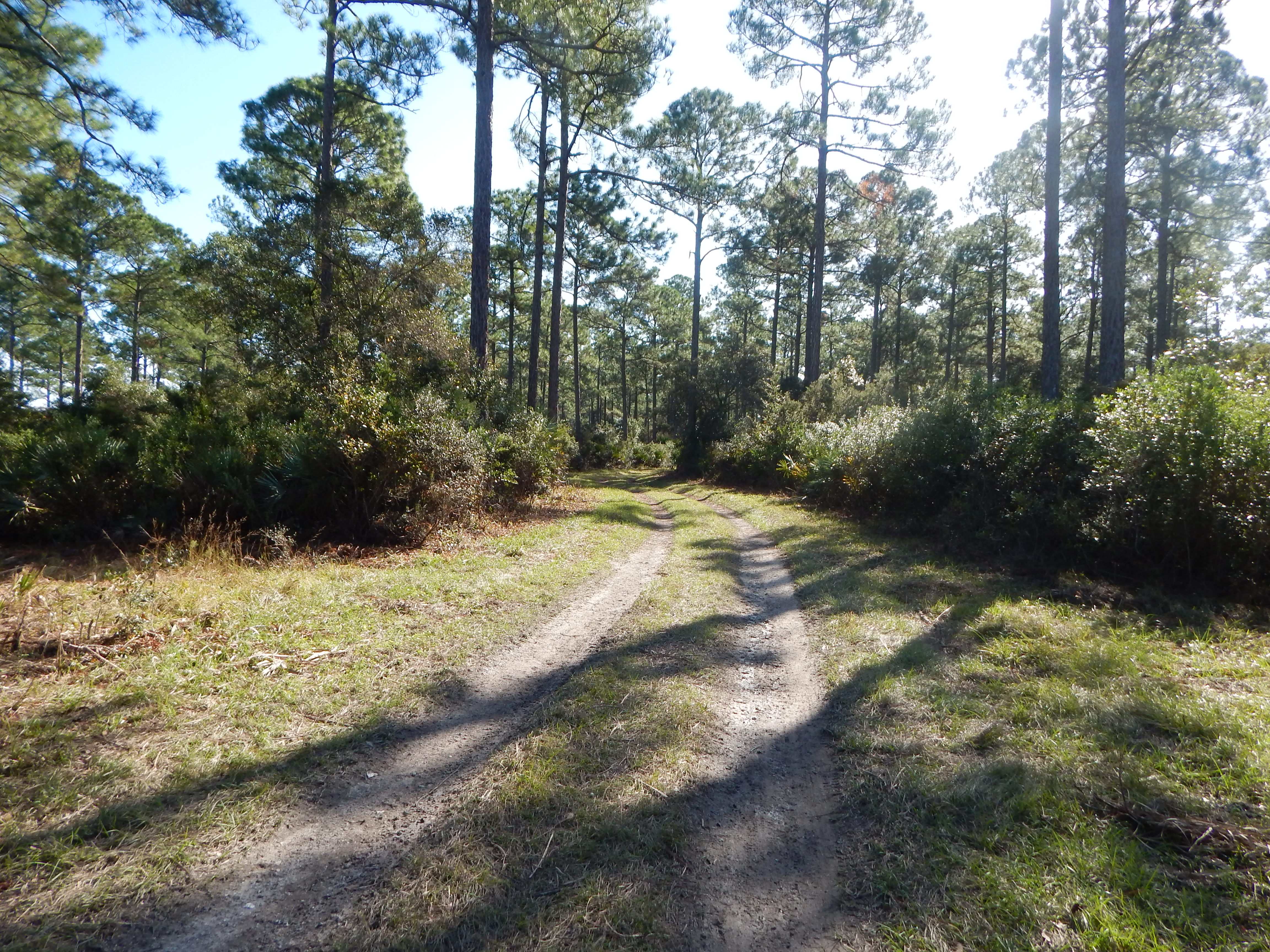
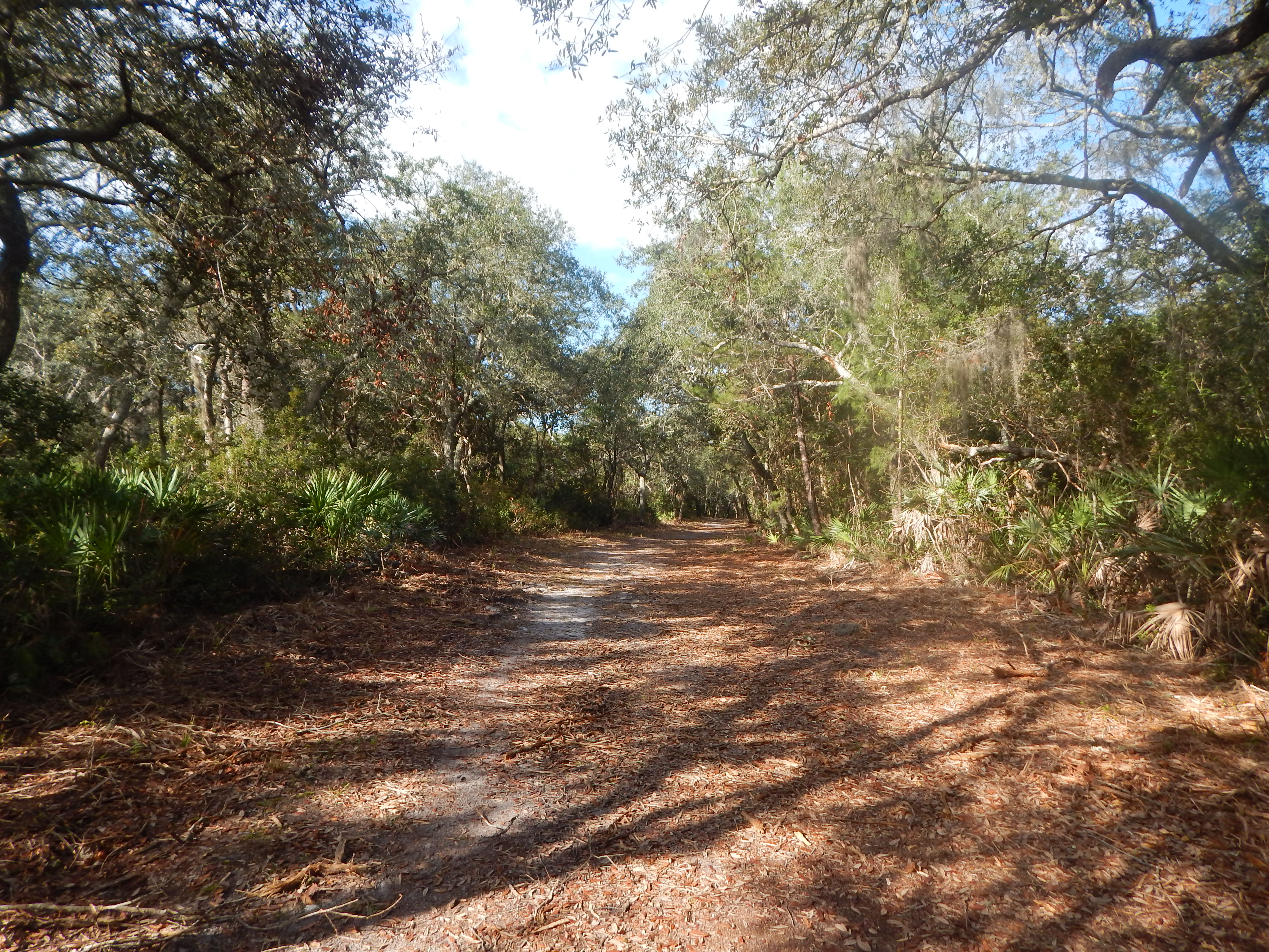
The main trail is sandy and then, as it re-enters the forest, it is a grassy lane. I soon reached the parking lot to complete another four+ mile hike.
On the way home, I traveled via SR A1A to search out some more possible future destinations. There are a ton of beaches along the way south of St. Augustine which I haven’t visited yet.
Well, another successful outing… I’ll go back and avoid the first two side trails and the bike paths this time and attempt to get a little further along the Yellow Trail.
In joy,
Eliza
Camera: Nikon Coolpix L830
Location, Moses Creek Conservation Area, St. Johns County
COMMENTS ON

Greetings Eliza,
Simply want to say how I appreciate all the content you generously share.
I watch and read these posts daily. Many thanks!
LikeLike
Hello,
Yet again you’ve produced a hiking foray which entertains and offers the most descriptive journey imaginable.
If I was able to reproduce one twentieth of this literacy output I’d be proud !
Wonderful………thanks,
denis
LikeLike
Thanks, Denis. Right now, this is my contribution to the Great Awakening. I believe in letting people make up their own minds. To best accomplish this, they need information and an open mind. Big changes are on the horizon for our world. And thanks for the comment. I appreciate hearing from the readers. ❤ Eliza
LikeLike