

Saturday a friend and I drove to Welaka State Forest, a preserve located off of County Road (CR) 309, south of the small town of Welaka and west of Crescent City. Years ago, I had explored many of the trails in this state forest and found myself remembering how to get around without much effort. I joked about having a GPS in my head; I’m just good with remembering maps. I had a rumpled paper map in hand, but it was simply verification.
The forest is used for agricultural studies by the University of Florida. There are tracts of regulated forestry consisting primarily of tall, slender Longleaf Pines, with an understory of trimmed Saw Palmetto, ferns, and blueberries.
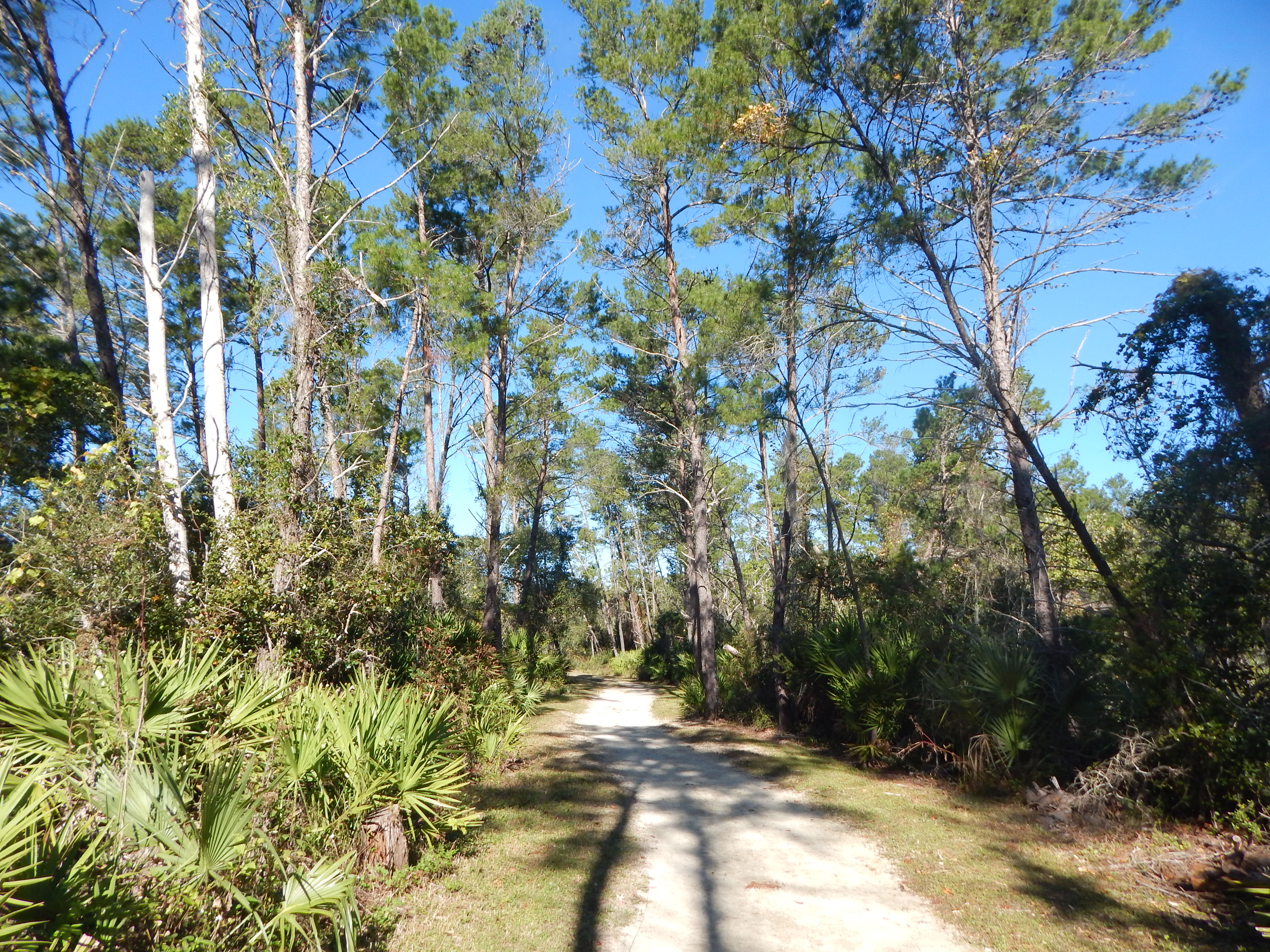
We parked at the trailhead for Orange Point, which is one of the camping spots in the forest. There is a pleasant park with picnic tables, a restroom and kiosks, with a fence defining the area. Passing through the fence, you are confronted with a choice, north or south? The sandy trail is Eagle Nest Way and runs mostly parallel to CR 309. It winds through forest until reaching another junction, where yet another choice presents itself, south or west towards Orange Point? We chose or rather I chose Orange Point, as I knew where I was going…
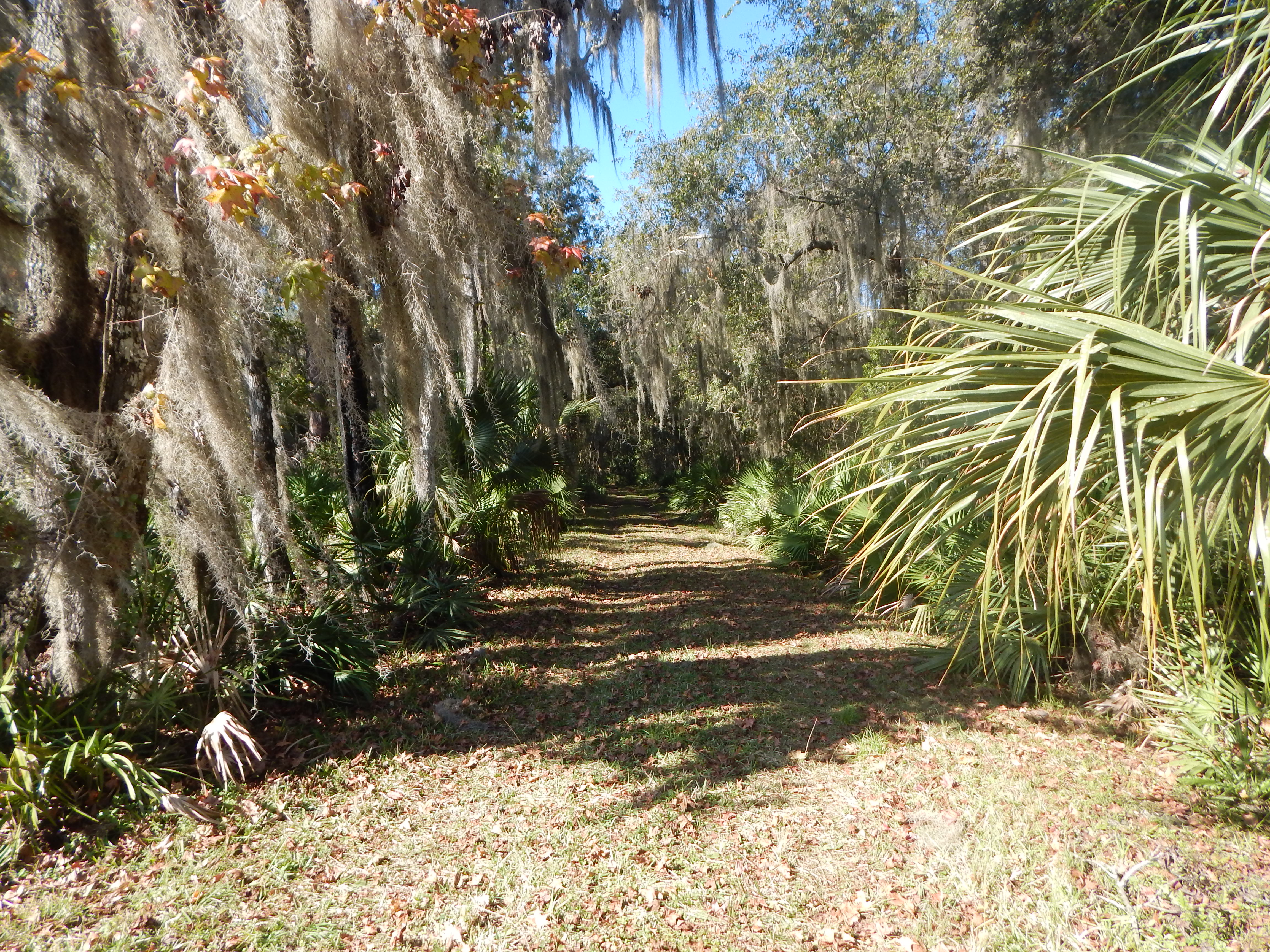
We walked along a dirt and grass vehicular road and then came to the trail that narrows and dives into the hammock… the trail to Orange Point. The various intersections are mostly marked with signage, but it does help to know where you’re going. The main road continues south and then makes a broad zigzag loop back to the previously mentioned intersection.

At the end of the pleasant forest walk, you arrive at Orange Point. There is no outhouse that I’ve ever seen, so it would be best to take the necessary tools. A truck can access the camping area on the narrow trail, although it might collect a few scratches on the paint. One time I visited the site, there were some forestry men who had driven their vehicle in and were surveying the area.

The trail guide where I first discovered a write-up for this area claims there are “great views” of the St. Johns River. That statement may have been true at one time, but the forest around the camp has grown and closed in. To get a view of the brackish river, you have to climb out on a narrow spit of land punctuated by a Sabal Palm at its terminus. There is no boat dock here, but a kayaker or canoeist could find a way to draw their craft out of the water.
My companion and I took a little break at the campground and then headed in the opposite direction, the way we had come, returning to Eagle Nest Way. I wanted to visit Mud Spring, too (see photo at top of article).

Eventually, we passed where we had parked the car and continued northwest towards Bobcat Crossing. (Editor’s note: I’ve seen TWO bobcats since moving to the new neighborhood).

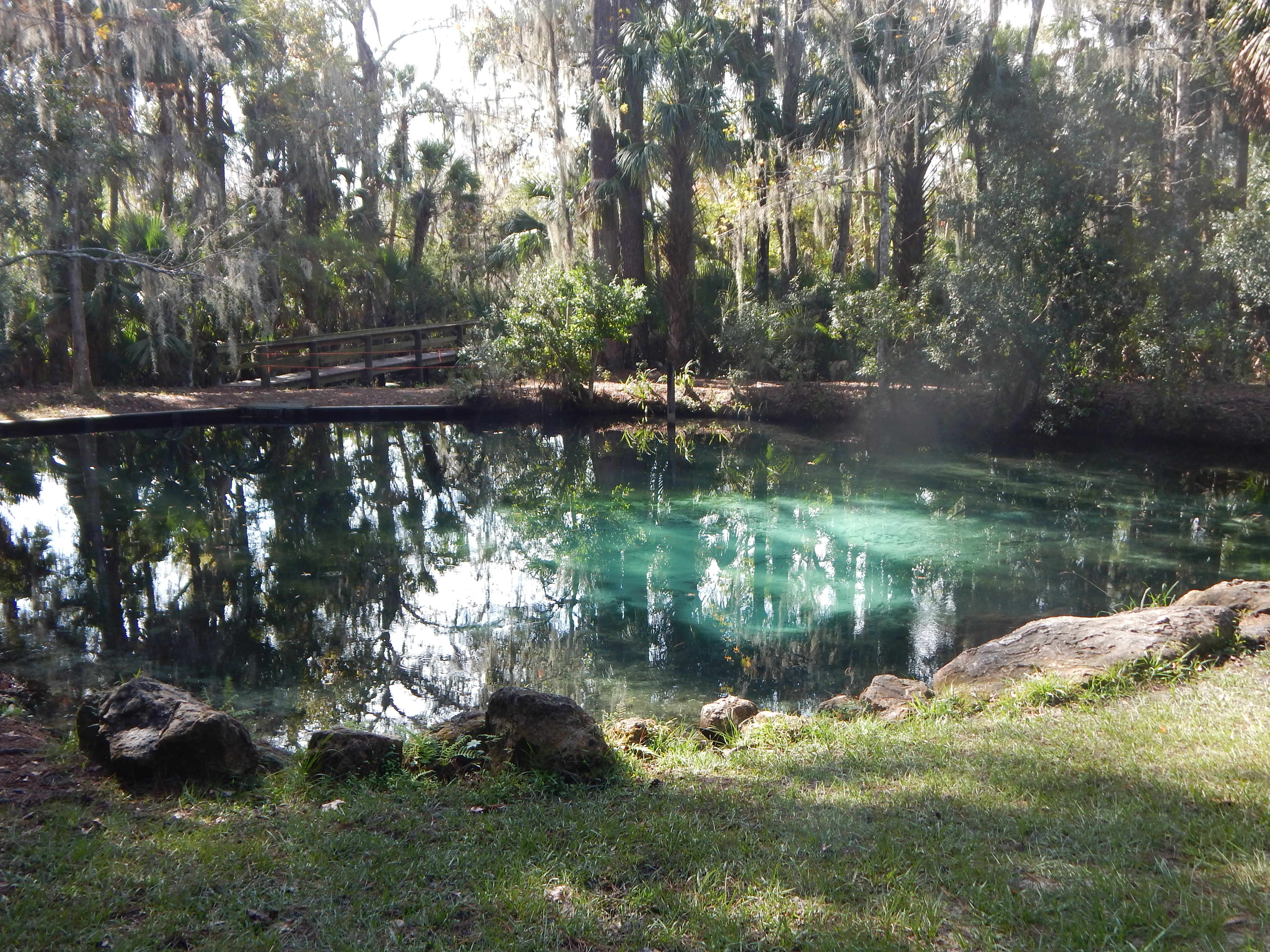
An unusual feature on this part of the walk is Sulphur Springs, an aptly named blue-tinted pool shaded by forest. A tiny creek pours out of the spring and crosses the road we were hiking on, but narrows down so you can easily step or jump over the water. The spring water is cold.
At Bobcat Crossing, you hang a left, now heading in a westerly direction towards Mud Springs. There is a northern trailhead for Mud Springs Trail which is probably the most visited area of the forest on the west side of CR 309. We didn’t walk that way today.
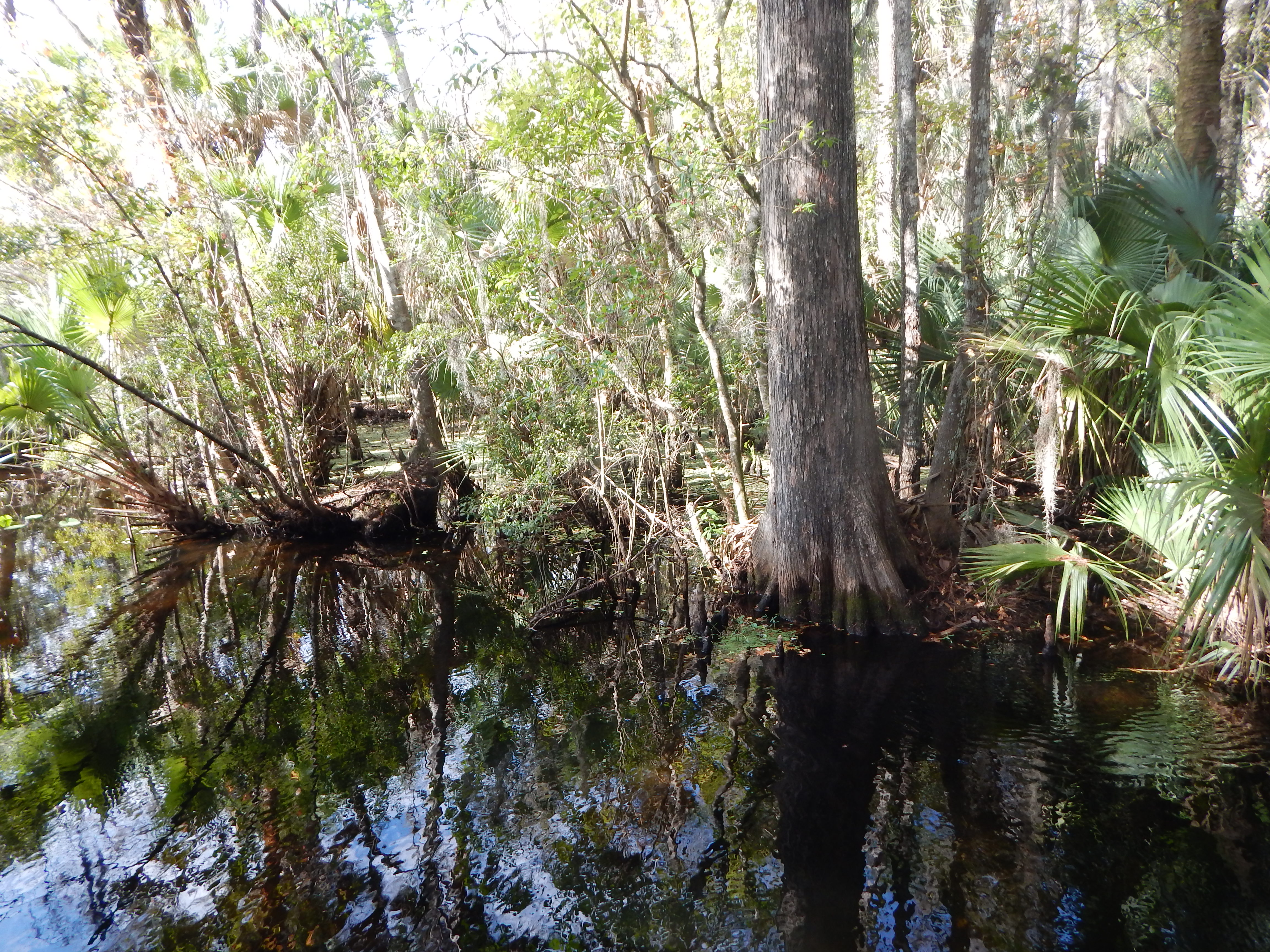
Mud Spring, is such a prosaic name for a pretty spring. The hiking guide claims the spring pumps out 1.4 MILLION gallons of fresh water daily. The water flows through a culvert and into the half-mile long Mud Creek Run, which empties into the St. Johns River. This is the sort of area that may attract manatee during the colder months as the spring water temperatures remain at a steady 72 degrees. Florida has many such natural springs.
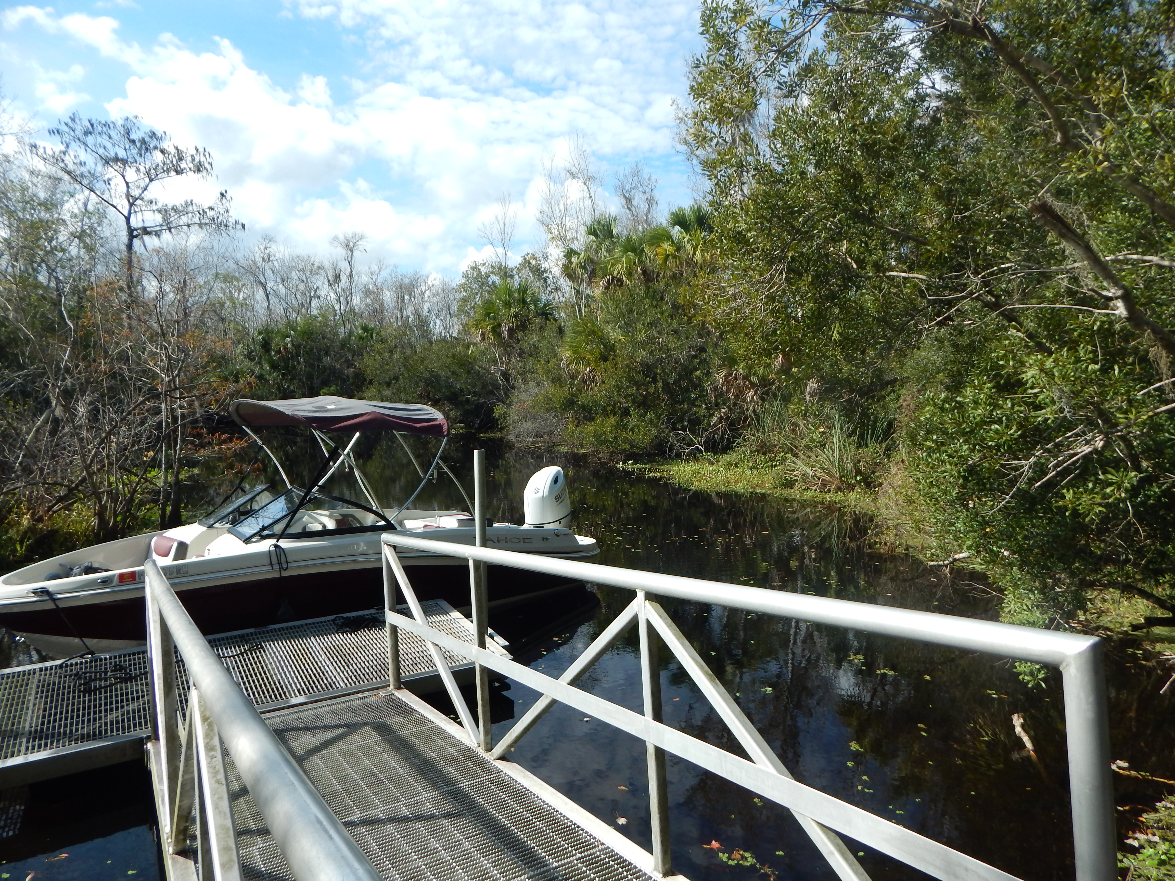
The Mud Springs area has a picnic shelter, restroom, kiosk, the spring-fed pool with a ladder, and a dock for small boats accessing the Run from the St. Johns River. There is a short boardwalk that takes you out to the dock, passing by a cypress swamp. Tiny fingerling fish dart through the crystalline waters. You cannot see the St. Johns River from the dock.
After another snack break at the springs, we headed back to the car. It was a fine warm and sunny day for a hike. We did not encounter any mosquitoes. The trails were in good condition, mostly dry. We did see quite a few people walking, usually with one or two dogs. It wasn’t crowded, but there were more people than I usually encounter when out hiking… still, it was a Saturday.
Nearby Welaka was setting up for their annual Christmas Parade, so we just squeaked by having the highway closed off. Access to Welaka can be made from the north off of U.S. Highway 17 or further south at Crescent City, traveling via CR 308.
After the hike, we drove to Crescent City. The cafe I intended to go to was closed; it’s only open for breakfast and early lunch. The cafe is also going to be closing. So, we headed to the Three Bananas for lunch, again. I had just been there a couple of days earlier. However, this time I was accompanied by my friend who knew all three former owners of the restaurant/bar. It changed hands a couple of years ago.

Well, there’s my report. Hope you enjoyed the photos.
This area of Florida has less population pressure than the coast. US Highway 17 travels north/south from the Jacksonville area. I would have to check a map to see how far south it goes, but it is a good road. There are also a ton of farms, small ranches, and nurseries in the area to the south of Crescent City. One nursery caught my eye, Starling Nursery, which had some beautiful plants growing in a wholesale setting. It was huge and I think rather new.
I also took a long walk on Thursday, but just to the Graham Swamp Trail, completing another four mile hike that day. I am getting my exercise, fresh air, and lots of Nature.
Greetings to all,
Eliza
COMMENTS ON
P.S. From a quick glance of the Google map, it would appear US 17 terminates at or near Sanford, FL. It is a US Highway, passing into Georgia. Still, if you don’t want to travel on the Interstate I-95, this route is slower but more scenic and gives you a glimpse into a slower, older Florida.

A super outing, especially when you are your own GPS and with a friend. Got to say I appreciate the Sky Blue. Thanks, Eliza, for sharing your adventures. Love, Altea
LikeLike